Surveying is the art and science of civil engineering that determines the relative (comparable) position of points on, above or beneath the surface of the Earth by measuring the horizontal and vertical distances, angles, elevations and taking the details of these points and by preparing a map or plan to any suitable scale.
For Instance, If we are talking about our position in a hill station, we say we are at 3000 feet above mean sea level (vertical distance). When talking about our position in a city, we refer to some landmarks near us (Horizontal distance).
Likewise, surveying identifies the position of points on or below the Earth’s surface by referring to known points, such as benchmarks.
According to the American Congress on Surveying and Mapping (ACSM), Surveying is the technique, profession, art, and science of determining the two-dimensional or three-dimensional positions of points and the distances and angles between them on or below the Earth’s surface.
Surveying has three functions:
- Determination of existing relative horizontal and vertical position of a point
- Reduction and interpretation of measured data to a usable form
- Establishment of marks to control construction or to indicate land boundaries according to given measurement requirements
Any Civil Engineering Project starts with surveying measurements or techniques to determine the boundaries between properties (land), the location of existing infrastructure, and the topography and slopes of a land.
Importance of Surveying
Surveying is an important technical discipline of Civil Engineering. The data gathered from surveying helps to establish boundaries of properties and routes of major engineering and infrastructure work such as roads, bridges, railways, irrigation canals, reservoirs, etc. Refer Importance of Surveying
History of Surveying
- 3100 BC – Rope stretcher (knotted cord) used to establish the boundaries
- 4th Century BC (400-301 BC) – Groma Surveying Instrument introduced.
- 2500 BC – Stonehenge was set out using peg and rope geometry
- 300 AD – Romans established basic measurements of land
- Early 1551 – Abel Foullon mentioned Plane Table.
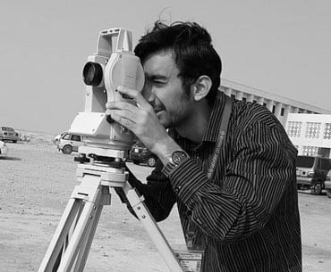
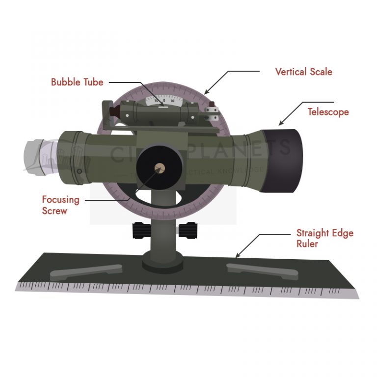
- 1571 – Leonard Diggies described Theodolite that measured horizontal angles
- 1576 – Joshua Habermel created a theodolite with a compass and tripod.
- 1615 – Willebrord Snellius introduced the modern systematic use of triangulation.
- 1620 – Edmund Gunter introduced Gunter’s chain.
- 1725 – Johnathon Sission was the first to incorporate a telescope on a theodolite
- 1771 – James Watt developed an optical meter for measuring distance
- 1787 – Jesse Ramsden introduced the first precision theodolite
- 1950 – Dr. Trevor Lloyd Wadley developed the Tellurometer
- 1950 – Geodimeter introduced electronic distance measurement (EDM) equipment
- 1970 – Introduced the early total stations